

MEASURING CHANGE: WHY ECOLOGICAL MONITORING MATTERS
Protecting a natural area is not the end of conservation work. It is the beginning of a long-term responsibility.
Forests, wetlands, wildlife populations, and environmental conditions continue to change after land is protected. Some changes are part of natural cycles, while others may be caused by climate change, invasive species, habitat fragmentation, recreation, or development.
To care for protected lands effectively, we need to understand what is present, how the ecosystem functions, and how those conditions change over time. This is the purpose of ecological monitoring.
WHAT IS ECOLOGICAL MONITORING?
Ecological monitoring is the repeated collection of information about species, habitats, and environmental conditions. While a single survey records conditions at one point in time, long-term monitoring uses consistent methods to compare observations across seasons, years, or even decades.
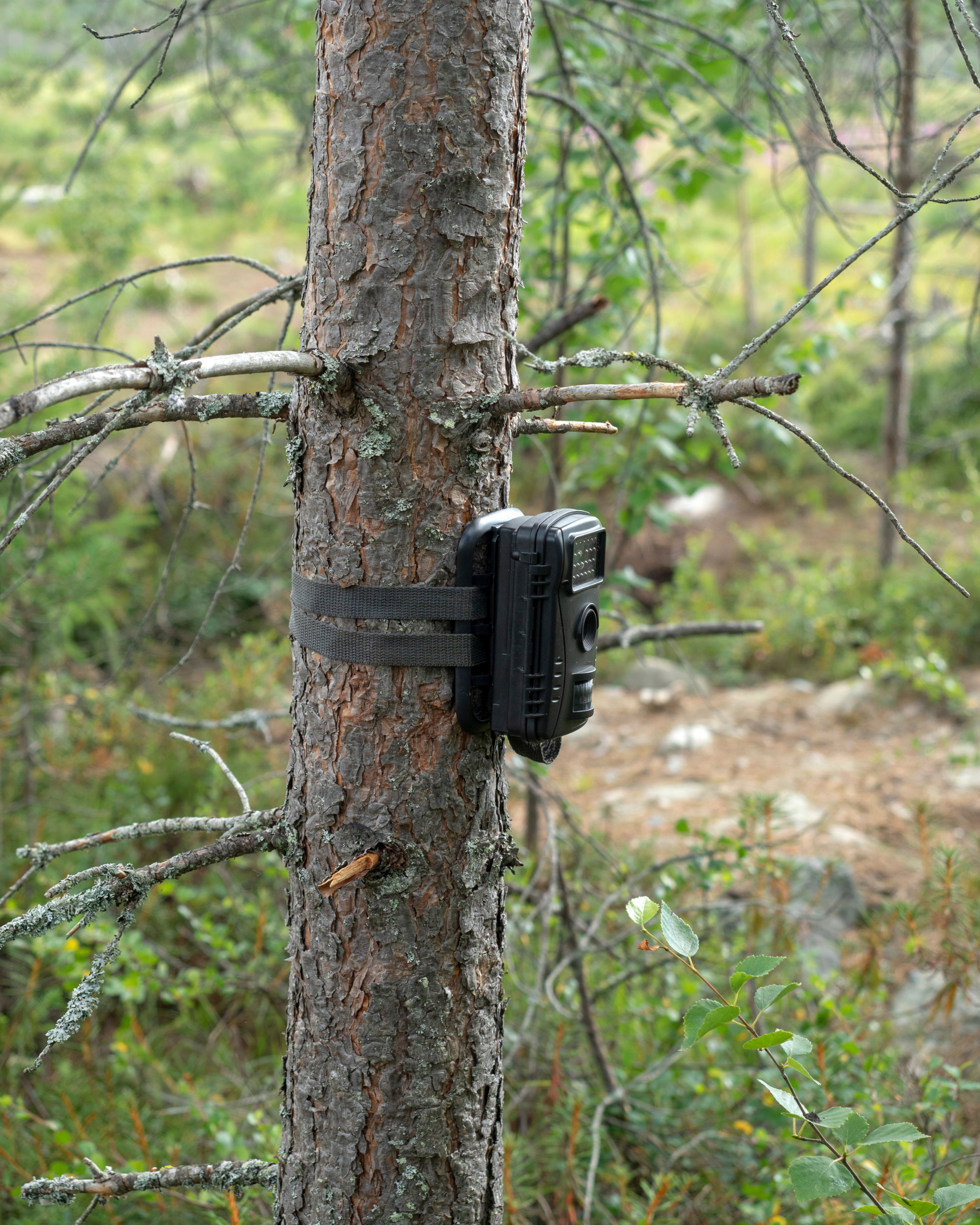
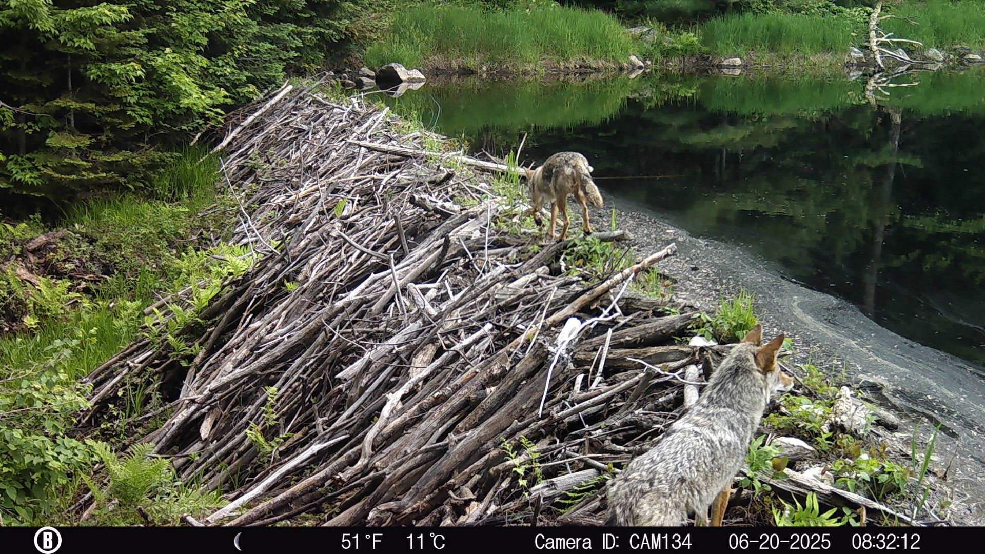
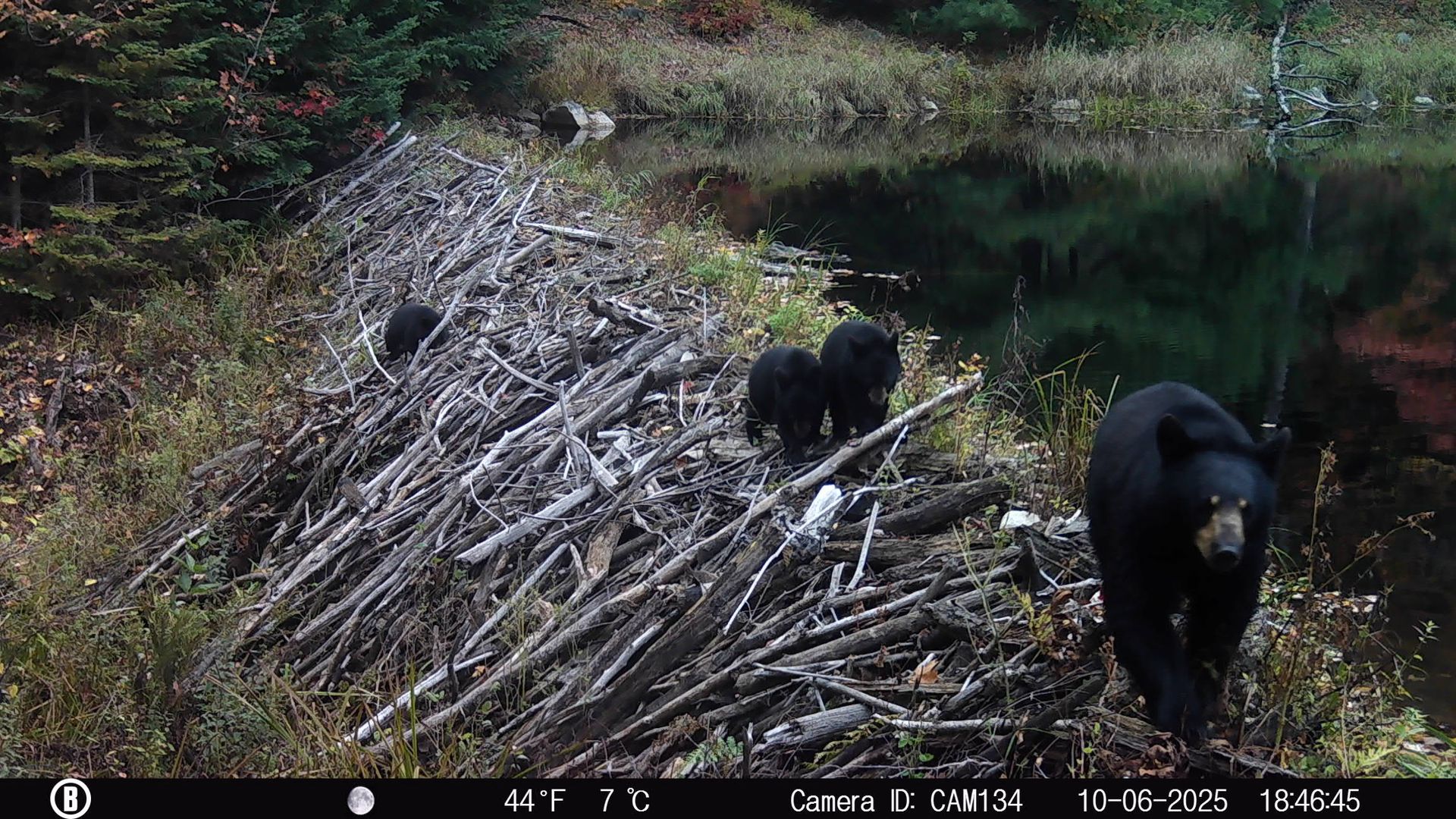
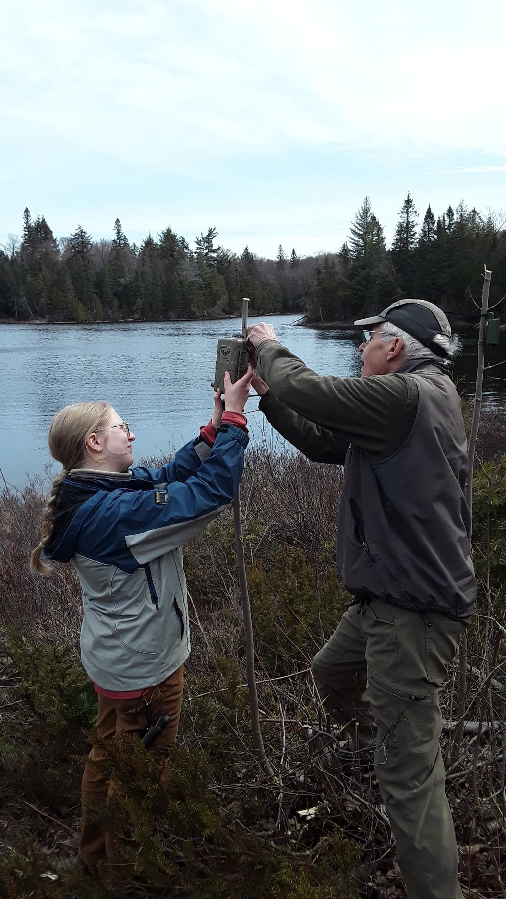
Monitoring can take many forms. Trail cameras document wildlife presence, activity, and movement with relatively little disturbance. Acoustic recorders can detect bats and birds that may be difficult to observe directly. Vegetation surveys provide information about forest composition and the presence of native, rare, or invasive plants, while water-quality monitoring can reveal changes in lakes, streams, and wetlands.
No single method can describe an entire ecosystem. When different types of information are considered together, they provide a clearer understanding of which species are present, how wildlife moves through the landscape, and whether habitats remain healthy and connected.
Many ecological changes happen gradually. Consistent monitoring allows researchers and land stewards to recognize patterns that might otherwise go unnoticed.
Trail cameras are one of the tools used by Algoma Highlands Conservancy to build this long-term record. You can learn more about the species documented across our research sites through our Wildlife Watch camera-trapping study.
WHY BASELINES MATTER
One of the most important outcomes of ecological monitoring is the establishment of a baseline.
An ecological baseline is a record of conditions during a defined period. It may include the species found in an area, the habitats they use, the timing of seasonal activity, and other indicators of environmental health. This information becomes the starting point against which future observations can be compared.
Imagine that wildlife is regularly documented moving through a particular section of forest. After several years of observation, the information may suggest that the area serves as an important corridor connecting feeding, resting, and breeding habitats.
If wildlife activity later declines along that route, we can compare the new information with the original baseline. The data may not immediately explain why the change occurred, but it can identify where further investigation is needed. Changes in vegetation, nearby development, recreational use, food availability, weather, or other pressures may be influencing how animals use the area.
Without a baseline, it is difficult to determine whether an observation represents a lasting ecological change, a temporary response to unusual conditions, or normal variation.
A baseline does not remain useful on its own. Its value depends on continued monitoring. Each new season of information adds context and makes it easier to distinguish short-term fluctuations from broader patterns.
FROM INFORMATION TO CONSERVATION
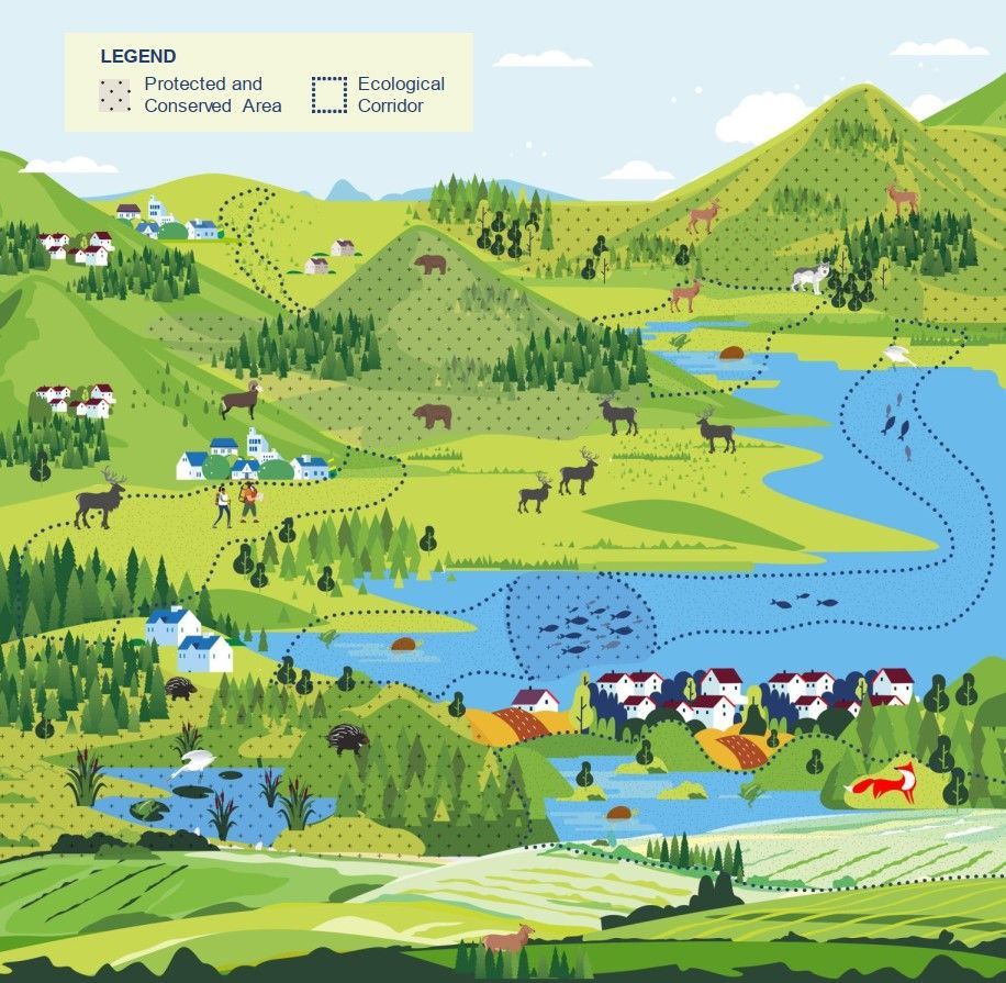
The value of ecological monitoring becomes clear when information collected in the past can help answer conservation questions today. AHC’s involvement in the Sault Ste. Marie and Garden River Ecological Corridor Project is one example.
Working alongside Ontario Nature, Garden River First Nation, and the City of Sault Ste. Marie, AHC is contributing historical trail-camera data to help address gaps in our understanding of wildlife movement. When combined with current field research, mapping, Indigenous knowledge, and local expertise, these records can help identify important ecological connections and show where roads, development, and other pressures may be affecting them.
Information gathered through long-term monitoring can therefore have value well beyond its original purpose. It can help identify habitats and wildlife corridors that require protection, guide future research, and support more informed conservation planning across the region.
A SHARED RESPONSIBILITY
Long-term ecological monitoring depends on collaboration. AHC volunteers, researchers, students, partner organizations, and community members each contribute different knowledge, skills, and resources.
Members of the public can contribute by recording wildlife, birds, plants, and insects through citizen-science platforms such as iNaturalist or eBird. Including an accurate date, location, photograph, and description of the surrounding habitat makes these observations more useful. However, the locations of nests, dens, and species at risk should not be shared publicly.
Visitors also support monitoring by staying on marked trails, keeping dogs under control, avoiding sensitive wildlife areas, and leaving trail cameras and other research equipment undisturbed. Volunteers and donors provide further support by helping make equipment maintenance, fieldwork, data management, and research partnerships possible.
Together, these contributions help build the long-term record needed to understand the Algoma Highlands as a living and changing system. The information collected today can help AHC recognize ecological change, evaluate its conservation work, and make informed stewardship decisions for years to come.

